GLACIAL TILLS OF THE GREAT LAKES
-
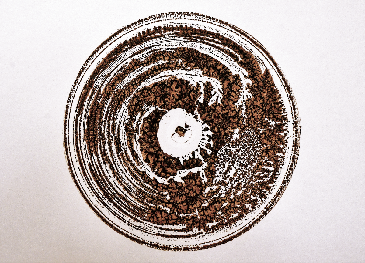
The Laurentide Ice Sheet slathered a thick layer of glacial clay over the entire Great Lakes region during the last ice age. The distribution pattern of these clays and tills has influenced the industrial and agricultural patchwork of the region, including brick works, industrial scale potteries, clay quarries, wineries and vineyards, and commodity farming. But the clay is not a homogenous in color, composition, or quality; veins of clay a mere 50 feet apart can be so different in terms of color that they appear to be unrelated.
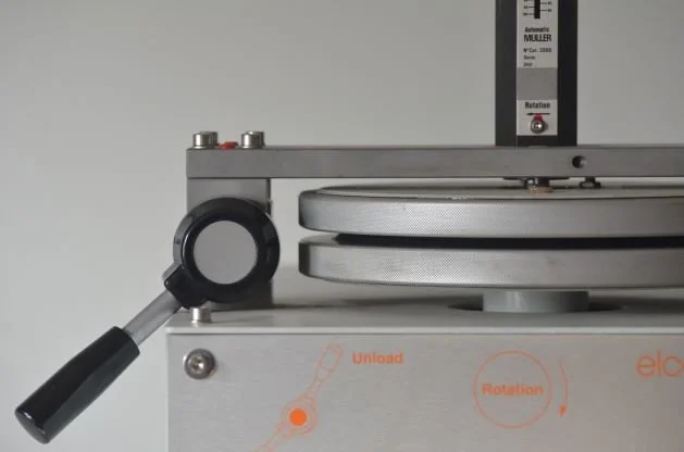
This project aims to produce a catalog and GIS map of the diversity of glacial till throughout the Great Lake region. Samples of glacial clay are being collected from 100 sites around the Great Lakes region, dried in a Yamato DX-300 Drying Oven, pulverized in a Raymond Mill, mixed with bleached linseed oil, and mulled in an Elcometer 2000 Muller Laboratory Grinder before being dispersed in a three-roll pigment mill and packed in aluminum paint tubes. From this stock of geocoded oil paint, an edition of chip decks is produced as artifacts of the project.
-
DATE: ongoing (2021-present)
MATERIALS: 100 glacial till samples, linseed oil
SCALE: fieldwork
DIMENSIONS: 100 tubes of oil paint (60ml), one from each of 100 sites
SITE: 100 sites around the Great Lakes region
STATUS: incomplete
-
An Attempt To Understand a Glacier Without Ever Having Seen One (archive record), Center for Art + Environment, Nevada Museum of Art.